Historical Highlights
In the period of the ice age the complete basin was covered by ice, going beyond the forks of Como and Lecco, reaching Brianza, where the hills ‘moreniche’ were shaped. The lake was formed from the cavity excavated by the ice. By the erosion signs in the rocks of the circling Como mountains you can see the ages pass clearly.
There are signs that in the prehistoric era the area was inhabited, and ages later the area became an important passage way in the transportation of goods from Germany to the sea. Also in the era of the Roman Empire, the area was given great importance.
Due to this importance many populations have fought over the area over the ages due to its advantageous positioning.
Around the year 1000, the city of Como became an independent council, however, always having to strive to keep their independence. The two main important families, the Visconti and Sforza families, believed in building an extension of the lake from the river Adda leading directly into Milan to ship goods to the city. There is a small port on the river in Paderno near Milan.
The area has been dominated by many foreign populations; first the Spanish, then the Austrians, and for a short period the French. In the last century Lake Como became famous due to the romance “I promessi sposi” by Alessandro Manzoni, set in the Lecco area.
Characteristics of the lake
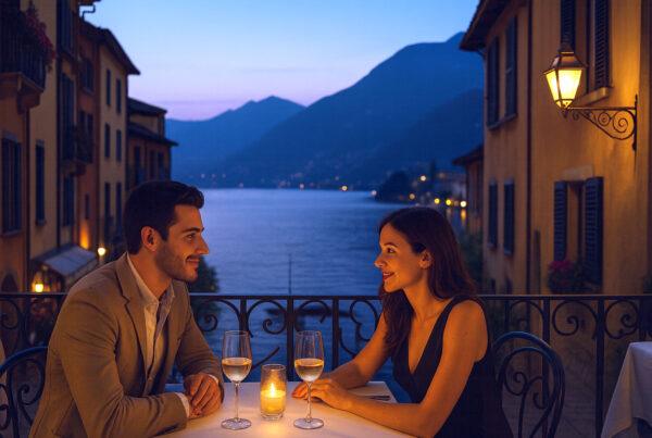
Lake Como, measuring 146 km is the third largest lake after Lake Garda and Verbano. It is characteristically shaped in an up-side-down ‘Y’ with three points: north is Colico, Lecco is south east, Como is south west, with a city spreading out in 170 km. The longest length is from Como to Gera Lario, 50 km; the widest breath is between Fiumelatte and Cadenabbia, 4,4 km; the shortest breath is between Careno and Torriggia, 650 m; the deepest point in the lake is between Argegno and Nesso measures 410m ( the deepest of all European lakes); the lakes’ height above sea level 199 m.
The lake is surrounded by mountains, the highest being Monte Legnone (2609 m), above Colico. There are 37 rivers running into the lake, of which the most important being the ‘Adda’, followed by the ‘Mera’. The Adda river is the only that leaves the lake; flowing out at Lecco and after running through the smaller lakes of Garlate and Olginate, continuing in the direction of the Po (the largest river in Italy).
There is only one island on the lake called ‘Isola Comacina’, situated in the Como leg, in front of the town Sala Comacina.
In the period of the ice age the complete basin was covered by ice, going beyond the forks of Como and Lecco, reaching Brianza, where the hills ‘moreniche’ were shaped. The lake was formed from the cavity excavated by the ice. By the erosion signs in the rocks of the circling Como mountains you can see the ages pass clearly.
There are signs that in the prehistoric era the area was inhabited, and ages later the area became an important passage way in the transportation of goods from Germany to the sea. Also in the era of the Roman Empire, the area was given great importance.
Due to this importance many populations have fought over the area over the ages due to its advantageous positioning.
Around the year 1000, the city of Como became an independent council, however, always having to strive to keep their independence. The two main important families, the Visconti and Sforza families, believed in building an extension of the lake from the river Adda leading directly into Milan to ship goods to the city. There is a small port on the river in Paderno near Milan.
The area has been dominated by many foreign populations; first the Spanish, then the Austrians, and for a short period the French. In the last century Lake Como became famous due to the romance “I promessi sposi” by Alessandro Manzoni, set in the Lecco area.
Characteristics of the lake
Lake Como, measuring 146 km is the third largest lake after Lake Garda and Verbano. It is characteristically shaped in an up-side-down ‘Y’ with three points: north is Colico, Lecco is south east, Como is south west, with a city spreading out in 170 km. The longest length is from Como to Gera Lario, 50 km; the widest breath is between Fiumelatte and Cadenabbia, 4,4 km; the shortest breath is between Careno and Torriggia, 650 m; the deepest point in the lake is between Argegno and Nesso measures 410m ( the deepest of all European lakes); the lakes’ height above sea level 199 m.
The lake is surrounded by mountains, the highest being Monte Legnone (2609 m), above Colico. There are 37 rivers running into the lake, of which the most important being the ‘Adda’, followed by the ‘Mera’. The Adda river is the only that leaves the lake; flowing out at Lecco and after running through the smaller lakes of Garlate and Olginate, continuing in the direction of the Po (the largest river in Italy).
There is only one island on the lake called ‘Isola Comacina’, situated in the Como leg, in front of the town Sala Comacina.